
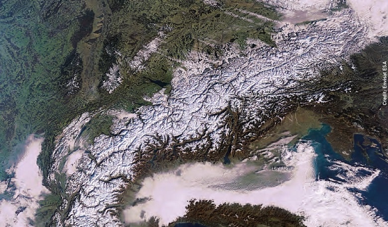
It is a sad but true statistic that several hundred people die every year in the Austrian Alps. The increase in skiing, hiking, and climbing tourism brings with it a variety of high risks. In case of accidents, the race against time is crucial and needs to be supported as much as possible.
There are many barriers that stand in the way of an efficient search-and-rescue operation. One of the biggest challenges is maintaining coordination among the search and rescue teams.
Traditionally there has been no automatic coordination. Information on team positions and the situation on-site were requested per radio. Yet in certain regions, radio is unavailable and the rescue teams could not be located.
A satellite-based command and control system can provide better support by improving the situational awareness and coordination of the rescue forces. This can considerably reduce the time needed by the teams to reach people in need of help. Therefore, the chances of survival are improved significantly.
New system
Sarontar (Situational Awareness and Command & Control of Rescue Forces in Alpine Regions) is a tailored system for search & rescue mission coordination providing a seamless data exchange between the operational control centre and the rescue teams.
It has been developed by TeleConsult Austria and provides an effective, coordinated satellitebased operations control system for rescue forces operating in the alpine region. The system is based on Global Navigation Satellite System (GNSS) for positioning and navigation.
Terrestrial and satellite communication is used to provide a high level of reliability and thus seamless communication between rescue forces, mission controllers and emergency management centres. In addition, topographic maps, high resolution orthographic photos and earth observation data can also be accessed to help the teams on the ground.
The current project, which is supported by ESA’s Integrated Applications Promotions programme, comprises the demonstration and pilot implementation of Sarontar in parts of the mountainous region of Styria, the second largest of the nine Austrian federated states located in the southeast of the country and covering 16,401 km?. This allows the system to be evolved to better match current user needs, placing it in good shape for when its moves out of its pilot stage.
Who uses Sarontar?
The user groups for Sarontar are the alpine rescue organisations including mountain rescue services and the alpine police in Austria. This includes the National Alerting and Warning Centres as they answer emergency calls regarding alpine accidents.
In Styria alone, the mountain rescue service is called 1,200 times per year on average. One tenth of these missions is classified as a ‘large mission’, in which more than 50 mountain rescuers divide into several mobile teams. These missions also involve members of external organisations like the rescue dog brigade or the crisis intervention team.
The National Alerting and Warning Centre now has direct access to the Sarontar mission control centre. This replaces the need to make phone calls to the regional mission controllers as the system will automatically alert them. Initial mission information for the local unit responsible for the area of the emergency can also be inserted easily in Sarontar, providing the local teams with everything they need to know to get to work, and then supporting them during the operation.
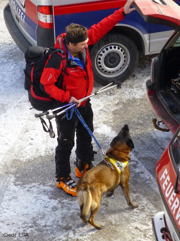 As well as satellites, rescuers used dogs to help them too.
It provides a way to display and manage all mission information using a web-based software platform as this makes the system hardwareindependent. Up-to-date information is provided by a continuous exchange of data which requires stable communication between mission control and search and rescue team. Highly detailed map data (topographical maps and geo-referenced orthographic photos) are necessary for mission control as well as for the mountain rescuers. Sarontar is designed to provide all of this.
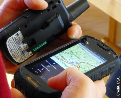 The smartphone displaying a map is installed with the Sarontar app, which switches automatically to the handheld satellite modem when terrestrial networks are unavailable.
System architecture
The Sarontar system is based on a client-server architecture. The server application is installed in the National Alerting and Warning Centre, while the mobile terminals and the mission control centre represent the clients.
The mobile terminals are ruggedised smartphones used by the search and rescue teams in the field. They run an app, which continually transmits timestamped positioning data to the mission control centre, offers a map displaying relevant geographical information for the current mission, and also provides an overview of the mission. Another function is available for exchanging messages with the server and mission controllers quickly and easily using only a few clicks.
There are many barriers that stand in the way of an efficient search-and-rescue operation.
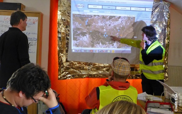
The search and rescue operation is coordinated and managed by the mission control centre. The coordinator is informed of the position of each search and rescue team during the operation and is able to communicate with them using this web application.
Messages are not exchanged directly but always via the server in the regional centre, which contains communication software and a database. The communication software reacts to incoming messages from the mobile clients and stores the information in its database. This builds a complete record of the communication between clients and server.
This is a major benefit of Sarontar as it can avoid a lot of effort for the rescue teams and mission control if documentation is needed. For example, a rescue mission report may be needed for use in court. Instead of reconstructing the events, Sarontar provides seamless documentation by recording everything in sequence automatically.
The system places special emphasis on maintaining communication. During natural disasters and even routine rescue operations, the availability of terrestrial communication is often limited or totally missing. To work around this, Sarontar uses satellite communication when terrestrial networks are unavailable. The rescuer is equipped with a handheld satellite modem. It communicates with the smartphone via Bluetooth and switches between terrestrial and satellite communication automatically when needed.
System test
A test of the Sarontar system was conducted on 7 February 2015 in the northern mountainous region of Styria. The exercise involved mountain rescue services from six local units who respond to emergencies in a 930 km2 area of the Alps. Around 50 mountain rescuers, the rescue dog brigade and the Alpine police were involved in the exercise.
The scenario involved two skiers who entered a steep rocky trench. One fell, was severely injured and therefore unable to move further. A group of tourists watched the accident and rushed to the victim to help. The movement unleashed a slab avalanche of approximately 250 metres in length, which buried them. The uninjured skier raised the alarm by calling the mountain rescue via the emergency call 140 but because everything happened so quickly, that person did not know the number of buried people.
So, the exercise comprised a systematic avalanche mission under real conditions and a technical rescue from a steep trench – all of which was supported by Sarontar. It provided mission control with an up-to-date and comprehensive view of the rescue status at all times. The mission coordination team quickly displayed a preference for the Sarontar system to their traditional mapping tool, and the rescue was successfully performed.
 A full test of the Sarontar system was conducted on 7 February 2015.
Afterwards, the mobile teams reported that the Sarontar smartphone application was easy to use. Before, there was no automatic continuous information transmission from the mobile terminals to the mission control centre. The exchange of up-to-date mission information provided through stable communication links is a major benefit. Furthermore, the definition and allocation of search areas for each rescue team provided a significant improvement for coordinating the overall mission.
Next steps
The project is currently in the validation phase. After the February test, several local units of the Styrian mountain rescue service agreed to be equipped with Sarontar hardware and software. This is allowing the system to be validated in real rescue missions as well as exercise missions.
Due to the installation of the Sarontar system at the National Alerting and Warning Centre in Styria, it will now be available for all Styrian mountain rescue services once the pilot project finishes.
In Styria alone, the mountain rescue service is called 1,200 times per year on average.
Further afield, contacts to other federated states in Austria and to neighbouring countries have been established, with interest in the system running high.
Although everyone hopes that Alpine tourists will not need the system to come to their aid, in the unfortunate event that they do need help, their chances of survival are now higher.