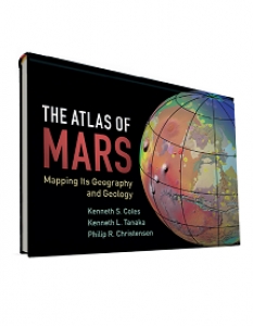
It is often said, without much backup, that we know more about the surface of Mars than the oceans of Earth, but a glance at this book could have you believing it. Following the publication, in 1979, of a global atlas based on Viking Orbiter photography, our knowledge of Mars was enhanced by the release of a global geological map in 1986 and a digital image of the entire surface in 1992.
In recognition of the fact that, with several orbiters currently at Mars, information is continually being updated, the authors tackle the obvious question of “why this atlas now?”. Their answer is based on the availability of more detailed imagery; an improvement in knowledge of Mars geology and relative dating via “crater counting”; and the ability of infrared and radar data to see below the surface. Mars lovers will simply be content to leaf through the pages and bury themselves in the fantastic imagery.
The first 60-odd pages include a brief history of exploration, an analysis of the global characteristics (such as albedo, elevation and dust coverage), regional geographic features (such as lowlands and impact basins) and a geological overview. Apart from appendices, references and an index, the remainder of the volume comprises the 30 “map sheets”, each with different projections showing features and colour-coded elevations along with images of various key features and explanatory text. This is a well-illustrated, large format book (36cm by 28cm) and is unusual in being printed in ‘landscape’ rather than ‘portrait’ format.
Viewing a planet from above always offers a fascinating perspective, but the level of detail available for Mars is now stunning, and the coloured geological maps are in some cases works of art. Meanwhile, the ‘oblique views’ of the landscape remind readers that, one day, they will form the ‘views out of the window’ for crews orbiting and landing on the red planet.


