 26 May 2022
Harnessing the power of geospatial data
26 May 2022
Harnessing the power of geospatial data
... on geography, natural climates, and prevailing weather conditions. Nature – Satellite cameras allow for real-time monitoring of deforestation around the world. Global Forest Watch monitors 600 million hectares of forest at any one time and...
 01 July 2016
The Week in Space: Business Digest
01 July 2016
The Week in Space: Business Digest
..., including cars, rucks, trains, ships, steel plant activity, refinery activity, imports, exports, oil drilling and deforestation. The company's staff is also expected to increase. Orbital Insight is unique in that it does not fly its own...
 20 July 2020
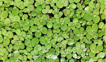
Satellite technology supports project to replace soy in livestock feed
20 July 2020
Satellite technology supports project to replace soy in livestock feed
... the world. However, soy relies on arable farming, requires a lot of water and contributes significantly to mass deforestation and biodiversity loss. Conversely, DryGro plans to cultivate duckweed in semi-cylindrical structures with closed loop water...
 14 June 2021
Space sector prepares for Sustainability Summit
14 June 2021
Space sector prepares for Sustainability Summit
... that accessing space-sourced data bring to society, including the use of satellites for monitoring climate change, deforestation, illegal mining or fishing, and even tracking endangered species or tracing food supply chains – all of which are...