Metaspectral, a remote sensing software company advancing computer vision using deep learning and hyperspectral imagery, has executed a Letter of Intent (LOI) with SkyFi, a company providing on-demand satellite imagery from a growing network of over 70 satellites.
Once integrated, SkyFi Earth observation data will be made available to users of Metaspectral Fusion, a cloud-based platform for the real-time analysis of hyperspectral imagery using deep learning models that are easy to train and deploy.
"This integration will make it possible for those using the Fusion platform to import satellite imagery directly from SkyFi and train AI models to identify a variety of objects or features in the imagery," said Francis Doumet, CEO of Metaspectral.
"Hyperspectral image analysis is incredibly powerful because the images contain information from beyond the visible spectrum, making it possible to characterize materials and gasses in the images, at the molecular level, using the imagery alone."
The next phase of the collaboration could see SkyFi adding hyperspectral image data and Metaspectral Fusion's analytics tools to its satellite imagery platform.
"Hyperspectral image analysis of satellite data has a wide range of potential uses including environmental monitoring of ice, snow, soil, forests, and oceans, and the identification of forest fires, methane leaks, and oil spills, long before most traditional methods, making it possible to potentially mitigate environmental disasters more quickly," said Migel Tissera, CTO of Metaspectral.
"It can also provide crucial data to intelligence, surveillance, or reconnaissance missions through its ability to detect chemical, biological, radiological, and nuclear (CBRN) material."
Metaspectral's technology is planned for deployment on the International Space Station (ISS) to demonstrate real-time compression, streaming, and analysis of hyperspectral data from low Earth orbit (LEO). The company is also working with the Canadian Space Agency (CSA) to use its technology to measure greenhouse gasses on the Earth's surface.
Metaspectral is delivering the next generation of computer vision software, capable of remotely identifying materials and determining their composition, condition, abundance and other properties, such as defects, otherwise invisible to conventional cameras.
It achieves this by leveraging hyperspectral sensors and analysing the data captured in real-time using artificial intelligence (AI) via its scalable, cloud-based platform. The software is already deployed in a range of industries including aerospace, defence, agriculture and manufacturing.
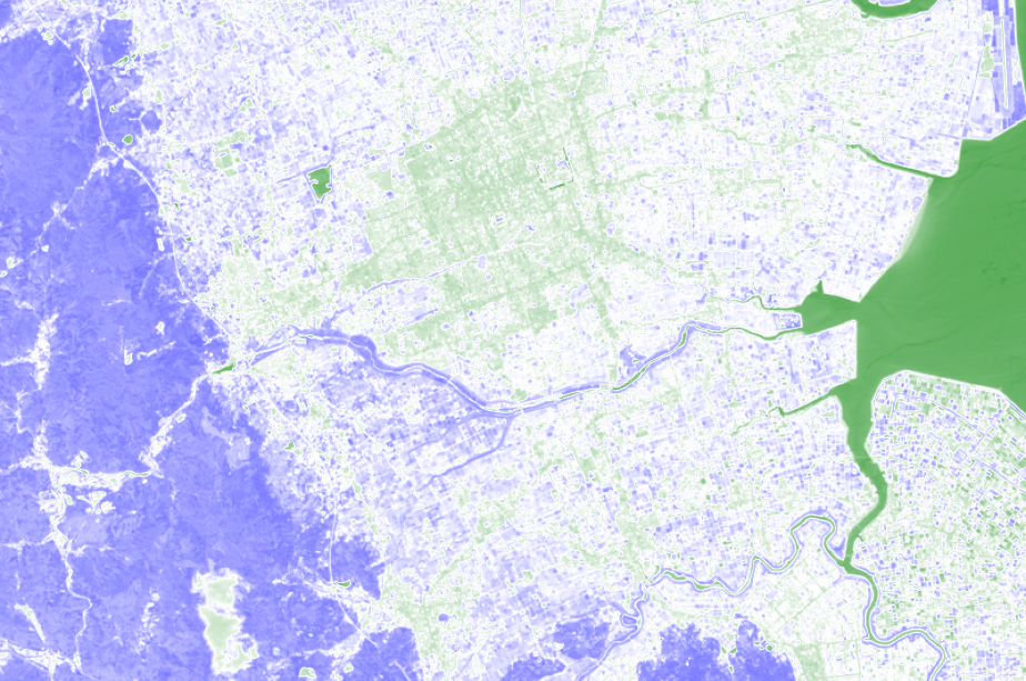
Image: NDWI (Normalized Difference Water Index) analysis, highlighting the presence of water bodies in a target location. Colours ranging from dark blue (no water present) to dark green (water is present). Credit: Metspectral.
Cloud-based platform to be used for satellite imagery analysis
