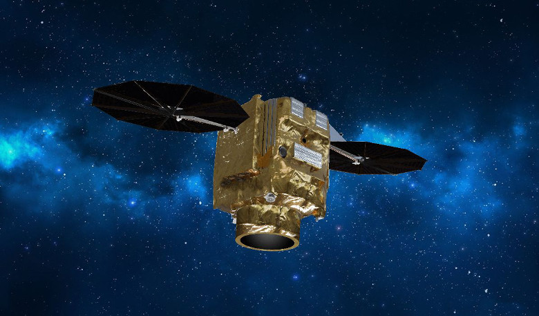
Airbus announces that it plans to reshape the Earth observation market with its Pléiades Neo constellation, as the production of four new very high resolution satellites gets underway.
The constellation is scheduled for launch in 2020 and once completed, the satellites will be the world’s first optical commercial satellites to utilise SpaceDataHighway.
The SpaceDataHighway is as the name suggests – a high-speed data transfer service that is designed for communication between Low Earth Orbit satellites. It is billed as ‘the most advanced high-performance alternative for space data transfer, providing data transmission in broadband quality in almost real time.’
By using SpaceDataHighway in its Pléiades Neo constellation, Airbus’s satellites will be able to immediately transfer data to the ground instead of waiting for up to hours before flying over a fixed ground station.
Also known as the European Data Relay System (EDRS), the SpaceDataHighway was developed through a public-private partnership (PPP) between Airbus and the European Space Agency (ESA). As such, Airbus’s Pléiades Neo satellites will be the first commercial constellation to be equipped with this technology.
“With Pléiades Neo, we will have the most advanced high-resolution constellation on offer for both commercial and secured governmental applications with another four satellites added to our existing Airbus fleet of 10 accessible Earth observation satellites,” said Evert Dudok, Head of Communications, Intelligence and Security at Airbus Defence and Space. “The fact that Pléiades Neo is equipped with the latest Laser Communication Technology gives our customers an advantage of speed that will be unrivalled in our industry for a long time.”
The very high communication bandwidth possible with lasers – of up to 1.8 Gbit/s – means that up to 40 terabytes of data per day can be transmitted securely in quasi-real-time to Earth. This is a boon for customers when it comes to the assessment of natural disasters for example.
“The four satellites will be equipped with reactive Ka-band terminals that will allow last minute tasking updates, even if the satellites are beyond their ground stations’ line-of-sight.,” reported Airbus in their recent press release.
With plans for their next-generation ground segments to offer machine learning, automated analytics applications, multi-mission capabilities and large-scale image processing, Airbus are on track to increase their digitalisation and connectivity services along with providing a breakthrough in Earth observation.


