

Researchers at the University of Manchester have developed a new way to design Earth-observation satellite missions that could help protect the space environment while continuing to deliver vital data for tackling global challenges, such as climate change, food production, supply chain vulnerabilities and environmental degradation.
Earth-observation satellites are increasingly relied upon to support efforts to meet the United Nations’ 17 Sustainable Development Goals (SDGs), providing critical data on issues like land use, urban development, ecosystems and disaster response. However, the rapid growth of satellite missions is also making Earth’s orbits more crowded and hazardous, increasing the risk of collisions and the creation of long-lasting space debris.
There are currently around 11,800 active satellites in orbit, but some predictions suggest that number could rise to more than 100,000 by the end of the decade. Collisions in space can generate large amounts of debris, threatening satellites, astronauts and the long-term usability of key orbital regions.
The new model, which links satellite mission objectives with collision risk as a key first step in mission design, is presented in the journal Advances in Space Research.
Lead author John Mackintosh, PhD researcher at Manchester University, said: “Our research addresses what is described as a “space sustainability paradox”, the risk that using satellites to solve environmental and social challenges on Earth could ultimately undermine the long-term sustainability of space itself.
“By integrating collision risk into early mission design, we ensure Earth-observation missions can be planned more responsibly, balancing data quality with the need to protect the orbital environment.”
Many applications that support the SDGs rely on very high-resolution satellite imagery. To achieve this level of detail, satellites often operate at lower altitudes, which reduces their field of view.
Alternatively, they can operate at higher altitudes but must be larger and heavier to carry bigger optical systems. This increases their exposure to space debris and makes collisions more likely and potentially more damaging.
Dr Ciara McGrath, Lecturer in Aerospace Systems at the University, added: “As satellite use continues to grow, our method offers a practical way to ensure that space remains safe, sustainable and usable for generations to come, while still delivering the data needed to address the world’s most pressing challenges.”
The new modelling framework allows satellite performance requirements and collision risk to be considered together during mission design, rather than being assessed separately or late in development.
The approach links mission requirements, such as image resolution and coverage, with estimates of satellite size, mass, the numbers of satellites in a constellation, and the level of debris present in different regions of low Earth orbit. This allows designers to explore how different mission choices affect both data quality and collision risk.
Using the model, the researchers found that collision risk does not simply peak where debris is most concentrated - satellite size also plays a major role. For example, for a satellite designed to deliver 0.5 m resolution imagery, collision probability was highest between 850 and 950 km above Earth - about 50 km higher than the peak in debris density.
The study also found that although higher orbits require fewer satellites to achieve coverage, those satellites carry a greater individual collision risk because they are much larger. Lower orbits need more satellites, but each one can be smaller and therefore less hazardous.
Katharine Smith, Professor of Space Technology at Manchester University, said: “The method could also be adapted for different Earth-observation systems and expanded to include more detailed space-environment impacts.
“In future work, we could account for how long debris fragments stay in orbit, how likely they are to hit other satellites, and the wider environmental effects of satellite re-entry. This would allow mission designers to evaluate trade-offs across the full sustainability picture.”
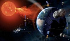
Photo: Augmented reality visualisation of satellites in the sky illustration. Credit: Conor Marsh/Rufus Clark - funded by UKRI-EPSRC.
New tool could reduce collision risk for EO satellites