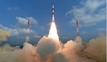
 May 2017
India confirms commercial launch intent
May 2017
India confirms commercial launch intent
... Indian - the primary payload being the 713 kg Cartosat-2 satellite which will be used for cartographic and remote sensing purposes, and two ISRO nanosatellites weighing 8.4 kg and 9.7 kg respectively. The additional 101 foreign micro and nano...
 August 2017
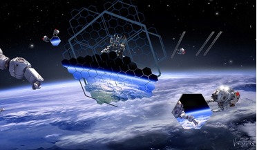
On-orbit assembly will deliver major benefits in coming decade
August 2017
On-orbit assembly will deliver major benefits in coming decade
..., policy studies and analyses in the space sector. She is a member of the US-NOAA Advisory Committee on Commercial Remote Sensing, and co-chairs a National Academy of Science committee on assessing the infrastructure for space radiation testing.
 February 2022
Revolution and responsibility: the challenges of space
February 2022
Revolution and responsibility: the challenges of space
... both orbits around the Earth (the circulation of satellites, the allocation of frequencies, the use of images from remote sensing, etc.) and the exploration of the solar system (the sterilisation of probes and, more broadly, planetary protection...
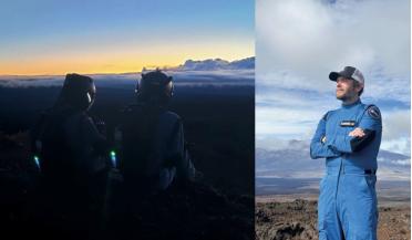 April 2026
Rethinking the spacesuit as a biological system
April 2026
Rethinking the spacesuit as a biological system
...on Earth, from energy to emergency response. In this sense, investment in human spaceflight capability reinforces broader societal resilience....Physicist, he has degrees in Physics, and Remote Sensing and Planetary Physics, as well as Solar Astrophysics research....
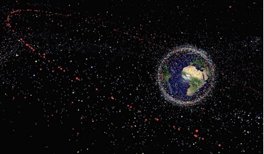 July 2014
Beware the situation: how JSpOC tracks space debris
July 2014
Beware the situation: how JSpOC tracks space debris
... citizens now consistently rely on spacecraft-supported communication, navigation and timing, imagery, and remote sensing information capabilities to conduct daily business. Space transportation initiatives have taken hold. Space is no longer...
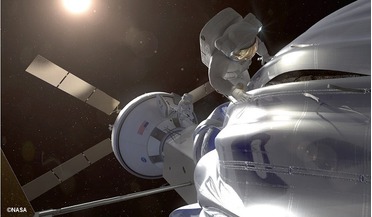 December 2014
Asteroid Redirect Mission: preparing for Mars in deep space
December 2014
Asteroid Redirect Mission: preparing for Mars in deep space
... would be developed for identifying samples based on their textural and mineralogical characteristics through a variety of remote sensing and in situ instruments. Involvement and support from ground-based science teams would be invaluable for...