 March 2015
Shipping, the environment and satellite AIS
March 2015
Shipping, the environment and satellite AIS
... awareness – the who, where and when on the water – is given by AIS. What is AIS? Automatic Identification System (AIS) is a mandatory navigation safety communications system demanded under the provisions of the Safety of Life at Sea (SOLAS...
 November 2017
Geospatial maritime solutions
November 2017
Geospatial maritime solutions
... maritime domain that could impact security, safety, the economy or environment. Within this domain, the Automatic Identification System (AIS) is used for collision avoidance on Aids-to-Navigation, and on aircraft involved in search and rescue (SAR...
 April 2021
Norway’s pioneering use of microsatellites
April 2021
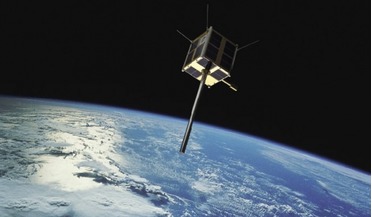
Norway’s pioneering use of microsatellites
... (FFI) took the initiative in 2006 to begin development of a small satellite. The satellite would collect Automatic Identification System (AIS) signals from ships that could thus be positioned, identified and tracked, as a tool for improving maritime...
 November 2017
Advancing maritime intelligence with real-time satellite AIS
November 2017
Advancing maritime intelligence with real-time satellite AIS
..., every ship over a certain gross tonnage is required to be fitted with an Automatic Identification System (AIS), a mandatory international navigation safety communications system under the provisions of the Safety of Life at Sea (SOLAS) Conventions...
 May 2018
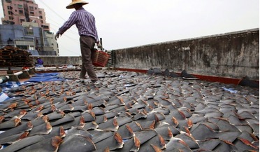
Satellite data helps combat illegal shark fishing
May 2018
Satellite data helps combat illegal shark fishing
... use for some years that can be used to monitor the location of fishing vessels. Automatic Identification System (AIS) and Vessel Monitoring System (VMS) data can be monitored by satellite and allow near real-time monitoring of any vessel’s movements...
 August 2018
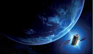
AI offers new approach to space situational awareness
August 2018
AI offers new approach to space situational awareness
...), we can also encapsulate the temporal information of an object or track. An example of this work is using maritime automatic identification system (AIS) data in order to model maritime traffic within an area. Concept for ESA’s future space debris...