 16 March 2018
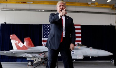
Trump suggests creating a Space Force to fight in space
16 March 2018
Trump suggests creating a Space Force to fight in space
While addressing an audience of service members at the Marine Corps Air Station Miramar in San Diego, U.S on Tuesday, President Trump talked candidly of creating a “Space Force,” a branch of ...
 March 2015
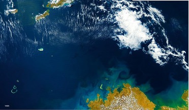
Shipping, the environment and satellite AIS
March 2015
Shipping, the environment and satellite AIS
... for ship identifications. To protect offshore installations and reduce the risk of maritime accidents and the resulting marine pollution, traffic exclusion zones and precautionary areas have been established. Precautionary areas might envelop wind...
 November 2017
Geospatial maritime solutions
November 2017
Geospatial maritime solutions
...degrees W. The AIS data from exactEarth was overlaid onto marine navigation software to highlight the tracks from the actual AIS... and for providing misleading reports to Transport Canada Marine Safety. exactEarth AIS offers capability to monitor and...
 February 2019
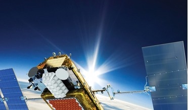
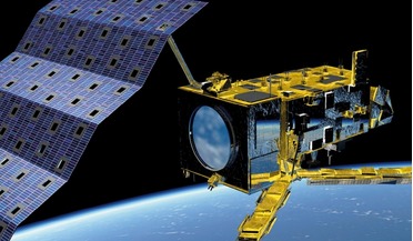
European system for global weather forecasting and climate change detection
February 2019
European system for global weather forecasting and climate change detection
...the continuity of critical high precision observations of ocean surface topography until 2030+, in full synergy with the marine mission of the Copernicus Sentinel-3 satellite. Joint Polar System (JPS) The EPS-SG programme is expected to be one of the...
 03 March 2016
Sentinel-3A Delivers First Images
03 March 2016
Sentinel-3A Delivers First Images
... important as it will contribute to the Copernicus Marine Environment Monitoring Service and the global land component ... ESA generating the land products and EUMETSAT the marine products for application through the Copernicus services. Alain...
 June 2017
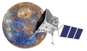
Bepi-Colombo will unveil Mercury’s secrets
June 2017
Bepi-Colombo will unveil Mercury’s secrets
... polar region, coloured by the maximum biannual surface temperature, which ranges from >400K (red) to 50K (purple). Mariner 10 remained the only spacecraft to probe Mercury until the recent MESSENGER (MErcury Surface, Space ENvironment, GEochemistry...