 August 2018
Earth observation game-changer
August 2018
Earth observation game-changer
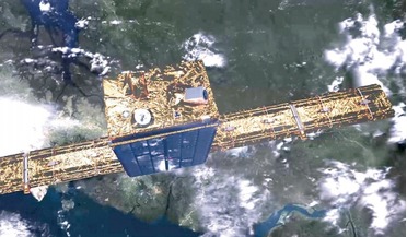
... have significantly decreased in proportion to the size of satellites and, as a result, SAR satellite constellations are now a viable data collection option for non-aerospace sectors. Leveraging this NewSpace approach, the first ICEYE commercial SAR...
 August 2018
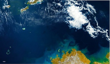
Monitoring marine litter by satellite
August 2018
Monitoring marine litter by satellite
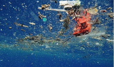
... are more directly connected with human activity. These data are necessary in order to calculate the global ... predictive computer models. If a remote sensing system could provide these data on a large scale, possibly at global level, it would have...
 October 2018
Developing wearable technologies for space and Earth
October 2018
Developing wearable technologies for space and Earth
... guide operations, enable real-time alerts, assist in on-task decision making, and provide an interface to comms, environmental data and other team members. Diagnostic Sensing incorporates autonomous responsive systems within the wearable garment for...
 April 2021
Norway’s pioneering use of microsatellites
April 2021
Norway’s pioneering use of microsatellites
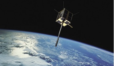
... officially allocated under the World Radio Conference (WRC) in 2019. The mission demonstrates the feasibility of a VHF data exchange protocol via satellite to ships, which could eventually lead to a new way of transmitting high priority information...
 04 November 2022
NASA’s climate change mineral dust detector
04 November 2022
NASA’s climate change mineral dust detector
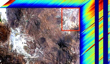
... the chemical composition of atmospheric mineral dust, is powered by hardware from high-performance electronics company Alpha Data. Data gathered by the NASA instrument - called the Earth Surface Mineral Dust Source Investigation (EMIT) - as the...
 March 2015
Shipping, the environment and satellite AIS
March 2015
Shipping, the environment and satellite AIS
... Mexico in 2006 highlight the critical need to protect the ocean environment. AIS for the environment S-AIS data provides accurate information on ship behaviour and position such that determining, or definitively concluding offences such as pollution...